
Many people don’t realize how drones can capture some very useful data for companies and professionals, especially when it comes to data analytics. With drone analytics software, users of the software can analyze the aerial data collected by the drones during their flights. Here are some of the best drone apps for data analytics!
7+ Drone Analytics Software
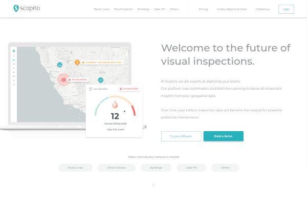
1. Scopito
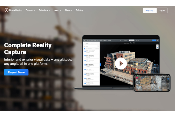
2. DroneDeploy
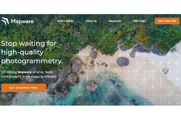
3. Mapware
4. Pix4Dcatch

5. PrecisionAnalytics

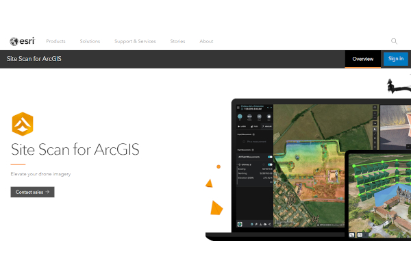
6. Site Scan for ArcGIS
7. Skyward.Io
8. ArcGIS Drone2Map
What Is Drone Analytics Software?
Drone analytics software is a combination of drone software and data analytics software that allows businesses to view data documented by drones. These data include maps, images, and measurements documented by the drone through the drone software.
Benefits
Drone analytics software helps businesses to visualize their potential projects using data gathered by drones. Its drone mapping software features help businesses to create new properties by knowing the measurements of the land they plan to develop their projects on. The cam drone app software also allows businesses to have a clear idea of the land of the area that may be inaccessible to enter. The software’s data analysis tools help the business’ data analysts to provide insights based on the aerial data documented by its drones. The software also helps businesses to inspect their areas to help strengthen their company’s health and safety protocols and minimize risks that could compromise the business as a whole.
Features
Drone analytics software should be able to document aerial data documented by the drone during its flights. These aerial data may be used for commercial use by the business to ensure that the ownership of the documented aerial data belongs to the business company. The data analysis software should be able to render these aerial data into 2D and 3D models whenever possible to help determine the land area. The software should also be able to provide business intelligence software tools to help business leaders to create well-informed decisions based on the documented aerial data. The
- Collect and process aerial data
- Aerial data for commercial use
- 3D and 3D visualizations
- Business intelligence tools
Top 8 Drone Analytics Software
1. PrecisionAnalytics
PrecisionAnalytics uses artificial intelligence software to help users provide complete aerial data that includes aerial mapping, modeling, and inspection. PrecisionHawk has 116 employees and earns annual revenue of $28.5 million.
2. Site Scan for ArcGIS
Site Scan for ArcGIS helps users to use drones to survey and collect aerial data on land sites. ArcGIS has 640 employees and earns a revenue of $123 million.
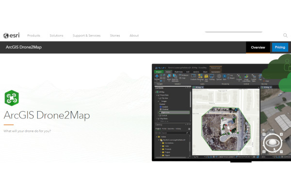
3. ArcGIS Drone2Map
ArcGIS Drone2Map helps users to map out their areas with their 3D mapping software. ArcGIS has 640 employees and earns a revenue of $123 million.
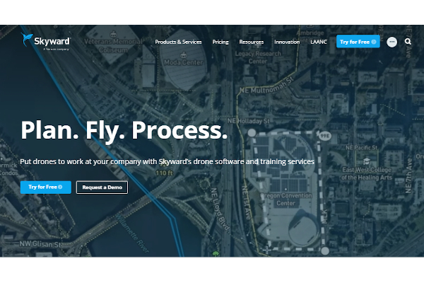
4. Skyward.Io
Skyward.Io’s drone software empowers companies to survey their area to collect aerial data. Skyware.Io has 561 employees and earns annual revenue of $81.3 million.
5. Pix4Dcatch
Pix4Dcatch allows users to capture aerial data and render them into 3D models with their 3D image scanner software. Pix4Dcatch has 640 employees and earns a revenue of $123 million. Pix4D has 225 employees and earns annual revenue of $32.6 million.
6. DroneDeploy
DroneDeploy allows users to use their drones to capture extensive visual images for interior and exterior projects. DroneDeploy has 222 employees and earns annual revenue of $22.9 million.
7. Scopito
Scopito provides next-level visual inspections software that gives users detailed information about their drones’ aerial data. Scopito has around 25 employees and earns a revenue of around $5 million.
8. Mapware
Mapware guides users to get straight to the point with their drone mapping software that can provide them high-quality photogrammetry data. Mapware has around 25 employees and earns a revenue of around $5 million.
FAQs
What other software users can use together with drone analytics software?
Businesses can use other software in conjunction with drone analytics software such as business intelligence software and data analysis software tools to help businesses furthered their aerial data from other analytical software to help leaders make well-informed decisions for their company through the combination of aerial data and other relevant third-party data.
What industries would benefit from drone analytics software?
The construction industry can benefit a lot from drone analytics software as it provides tools to help determine the aerial data of their construction data. Architects can also benefit from drone analytics software as it can help them get a clear idea of the land dimensions on which they plan to develop their projects on. The agricultural industry can also benefit from the software to help them analyze and monitor their farmlands. Some drone analytics software may provide specialized software that is optimized for specific industries such as agriculture drone software and enterprise drone analytics software.
With the drone analytics software, users such as companies can process aerial data effectively that can be useful for their land projects or enhancing risk management protocols.
Related Posts
10+ Best Chemical Software for Windows, Mac, Android 2022
12+ Best Vulnerability Scanner Software for Windows, Mac, Android 2022
4+ Best Bundled Pay Management Software for Windows, Mac, Android 2022
10+ Best Trust Accounting Software for Windows, Mac, Android 2022
10+ Best Patient Portal Software for Windows, Mac, Android 2022
13+ Best Virtual Reality (VR) Software for Windows, Mac, Android 2022
12+ Best Bed and Breakfast Software for Windows, Mac, Android 2022
15+ Best Resort Management Software for Windows, Mac, Android 2022
14+ Best Hotel Channel Management Software for Windows, Mac, Android 2022
12+ Best Social Media Monitoring Software for Windows, Mac, Android 2022
10+ Best Transport Management Software for Windows, Mac, Android 2022
10+ Best Other Marketing Software for Windows, Mac, Android 2022
10+ Best Top Sales Enablement Software for Windows, Mac, Android 2022
8+ Best Industry Business Intelligence Software for Windows, Mac, Android 2022
10+ Best Insurance Agency Software for Windows, Mac, Android 2022