
Drones can do so much to help capture aerial photography and make them profitable for commercial use. With enterprise drone analytics software, companies can create new maps, get new measurements of the area, and many more, all for commercial use. Here are some of the best drone apps for enterprises available right now.
7+ Enterprise Drone Analytics Software
1. DroneDeploy
2. Scopito
3. Mapware
4. Pix4Dcatch
5. PrecisionAnalytics

6. Site Scan for ArcGIS
7. Skyward.Io
8. ArcGIS Drone2Map
What Is Enterprise Drone Analytics Software?
Enterprise drone analytics software is a data analytics software that allows businesses to collect data using drones and analyze the gathered data available. Through the drone s app, the drones give data analytics that would help them create 3D visual maps, as well as allow them to give them exact measurements of the surrounding areas around the captured visuals by the drone.
Benefits
Enterprise drone analytics software allows data analysts to collect data about the land through drone mapping software that allows them to measure the area captured by the drone. Drone software also gives opportunities for map makers to create new maps based on the visual data captured by the drones. Its cam drone app features allow drones to create both 2D and 3D visuals of the footage captured, giving users versatile options for data mapping.
The drone mapping app also helps companies evaluate the danger and risk occurring in an area safely without compromise someone’s well-being. Likewise, the drone roof inspection software also allows users to inspect rooftops and other hard-to-reach areas, either to look for something or to capture new visual data.
Features
Enterprise drone analytics software should be able to record visual aerial data from drones flying. The drone deploys app should be able to render 2D and 3D models of the captured area based on the visual data collected by the drones connected to the software. All of the content created through this software should allow users to use drone data for commercial use. The software should also be able to cater to various industries with specialized tools and features that cater to different industries.
- Record aerial data from drones
- Render 2D and 3D digital models
- Use for commercial purposes
- Cater to various industries
Top 8 Enterprise Drone Analytics Software
1. PrecisionAnalytics
PrecisionAnalytics uses artificial intelligence to help users provide accurate aerial data analytics with automated tools and reporting tools. PrecisionAnalytics has around 25 employees and earns a revenue of around $5 million.
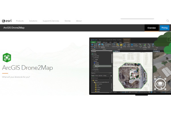
2. ArcGIS Drone2Map
ArcGIS Drone2Map empowers users to create new maps with their drone mapping software. ArcGIS Drone2Map is owned by Esri, which the parent company has 4,000 employees and earns a revenue of $840 million.
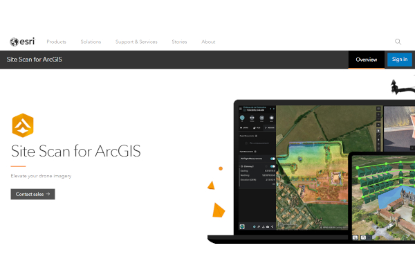
3. Site Scan for ArcGIS
Site Scan for ArcGIS provides an end-to-end cloud server-based drone mapping software that allows users to develop detailed imagery data possible. Site Scan for ArcGIS is owned by Esri, which the parent company has 4,000 employees and earns a revenue of $840 million.
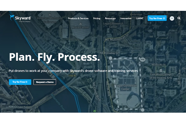
4. Skyward.Io
Skyward.Io empowers drones that allow capturing the aerial data needed for commercial use. Skyward has 561 employees and earns annual revenue of $81.3 million.
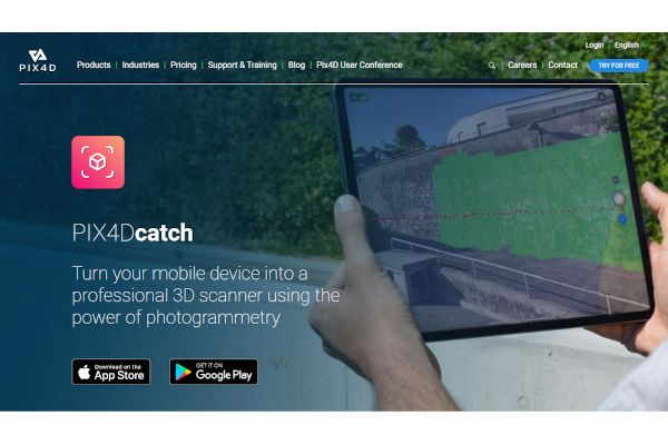
5. Pix4Dcatch
Pix4Dcatch allows users to turn their mobile device into a powerful 3D mapping software using the power of photogrammetry software tools to provide quick map results that don’t require extensive devices. Pix4Dcatch has 324 employees and earns a revenue of $60 million.
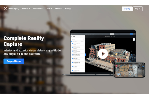
6. DroneDeploy
DroneDeploy provides an extensive, powerful 3D mapping software that allows users to visualize their interior and exterior data. DroneDeploy has 168 employees and earns annual revenue of $22.9 million.
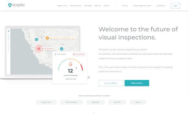
7. Scopito
Scopito’s risk management software allows users to monitor their critical assets to help them keep secure over their aerial data. Scopito has around 25 employees and earns a revenue of around $5 million.
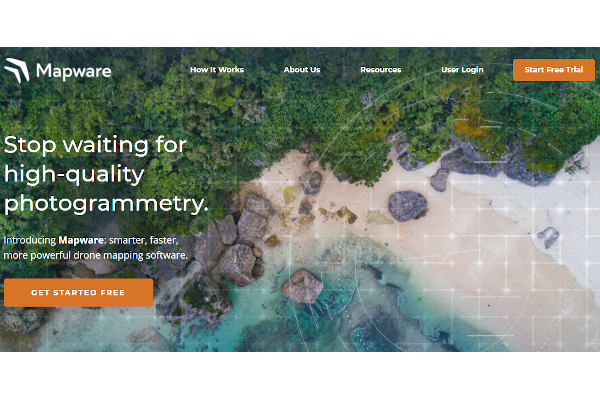
8. Mapware
Mapware empowers users with its powerful mapping software that uses the power of drone photogrammetry to provide smart and fast drone mapping solutions. Mapware has around 25 employees and earns a revenue of around $5 million.
FAQs
Can enterprise drone analytics software be used for agricultural purposes?
Enterprise drone analytics software can be used for agricultural purposes, specifically for analyzing farm lands. That being said, there are specialized drone analytics software called agriculture drone software that tackles specific agricultural droning solutions. As such, users who seek to use drone analytics software for agricultural purposes may benefit more from specialized agricultural drone software.
Is enterprise drone analytics a standalone software or a feature of another software?
Enterprise drone analytics software is usually standalone software since it has specific tools where drone data is used for enterprise and commercial uses. By using this software for drone data purposes, users won’t need to use business intelligence software for these specific solutions.
How much does enterprise drone analytics software cost?
Pricing for enterprise drone analytics software range from free to $291.67 per month or more, with custom pricing available for some software. Pricing for enterprise drone analytics software varies depending on the features available and the intended target company. Small companies may benefit from free or low-cost enterprise drone analytics software, while large companies may benefit from high-cost software.
There’s an opportunity for companies to take advantage of enterprise drone analytic software that makes their precious drone data into a profitable business that earns them income.
Related Posts
10+ Best Chemical Software for Windows, Mac, Android 2022
12+ Best Vulnerability Scanner Software for Windows, Mac, Android 2022
4+ Best Bundled Pay Management Software for Windows, Mac, Android 2022
10+ Best Trust Accounting Software for Windows, Mac, Android 2022
10+ Best Patient Portal Software for Windows, Mac, Android 2022
13+ Best Virtual Reality (VR) Software for Windows, Mac, Android 2022
12+ Best Bed and Breakfast Software for Windows, Mac, Android 2022
15+ Best Resort Management Software for Windows, Mac, Android 2022
14+ Best Hotel Channel Management Software for Windows, Mac, Android 2022
12+ Best Social Media Monitoring Software for Windows, Mac, Android 2022
10+ Best Transport Management Software for Windows, Mac, Android 2022
10+ Best Other Marketing Software for Windows, Mac, Android 2022
10+ Best Top Sales Enablement Software for Windows, Mac, Android 2022
8+ Best Industry Business Intelligence Software for Windows, Mac, Android 2022
10+ Best Insurance Agency Software for Windows, Mac, Android 2022